Geography and Setting
Ha Giang City occupies 135.33 km² on the banks of the Lo River in the northeastern corner of Vietnam (베트남 / 越南 / ベトナム). Its population hovers around 55,500 (2019 census), but the number that matters to travelers is zero — the real draw is the province surrounding it.
The city sits at the threshold. Head south and you're back in the flatlands. Head north or east, and the terrain buckles into the kind of landscape that justifies a motorbike trip: limestone plateaus, river gorges, and switchbacks that demand full attention. The Lo River bisects the city roughly north-south, and most traveler services sit on the western bank. Cross the bridge east and the town thins out fast — within 10 km you're already climbing.
Ha Giang City sits roughly 300 km north of Hanoi by road, but the distance is deceptive. The terrain between the two is not flat delta; once you pass Tuyen Quang province, the road starts winding through foothills. Expect the bus ride to take 6-7 hours even though the kilometer count suggests less.
The Ha Giang Loop and Beyond
The Ha Giang Loop — a roughly circular motorbike route on National Highway 4C (QL4C) — is why most people know this province exists. The loop passes through Lung Cu (home to the Lung Cu Flag Tower at 1,534 meters), Dong Van district, Sa Phin, and Meo Vac. Each stop reveals a different slice of highland life: karst formations, Hmong villages, tea terraces, and roads that switchback like a spiral staircase.
The Dong Van Karst Plateau Geopark, designated in 2010, brought official recognition to the geology and ecology driving the tourism boom. It's worth understanding what you're looking at: these aren't just pretty hills. They're limestone formations shaped by water and time, with distinct plant life and a climate that shifts as you climb.
Most riders do the loop in 3-4 days. A common itinerary runs Ha Giang (하장 / 河江 / ハーザン) City to Yen Minh (about 100 km, 3-4 hours riding), then Yen Minh to Dong Van (45 km), Dong Van to Meo Vac (about 22 km via the Ma Pi Leng Pass), and Meo Vac back to Ha Giang City (around 150 km). The Ma Pi Leng section is the one everyone photographs — a narrow road carved into a cliff face above the Nho Que River, with drops that make your palms sweat. The river below is a shade of green you won't forget.
Beyond the standard loop, riders with more time push further: Du Gia commune southeast of Meo Vac, or the road to Bac Me district, see far fewer tourists. These extensions add a day or two but reward you with near-empty roads and villages where a foreign face still draws genuine curiosity.
Ethnic Diversity
Ha Giang Province is home to at least 22 ethnic groups, though Kinh (ethnic Vietnamese), Tay, Dao, and Hmong make up the bulk. Each group has its own language, dress, cuisine, and settlement patterns.
For a visitor, this diversity means the experience changes as you move through the province. A market in Dong Van looks and sounds different from one in Meo Vac. Stay overnight in a village homestay and you'll eat what that community eats — usually rice, vegetables, preserved meat, and foraged greens, often with corn or cassava as secondary staples.
The Sunday markets are where this diversity is most visible. Dong Van's Sunday market draws Hmong, Lo Lo, Pu Peo, and Tay people from surrounding villages. They come to trade livestock, buy fabric, and socialize — it's not a tourist performance. Meo Vac holds a similar market on Sundays. Arrive early (before 8 AM) to see the livestock trading area, where water buffalo and pigs change hands. By midday the crowds thin. These markets also sell "thang co," a sour organ-meat soup that's a Hmong specialty — an acquired taste, honestly, but worth trying at least once. A bowl runs about 20,000-30,000 VND.

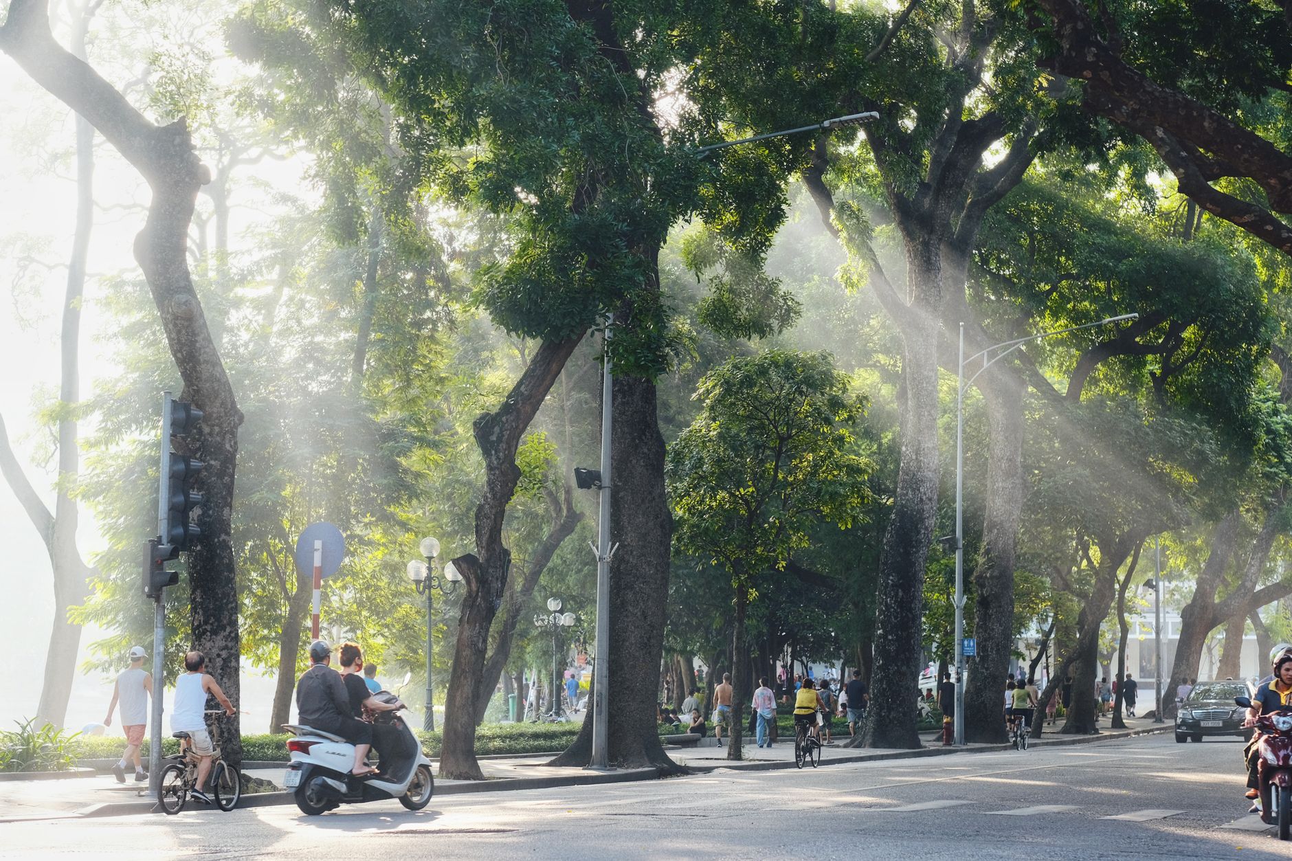
Image by Cheong. Original uploader was Cheong Kok Chun at en.wikipedi via Wikimedia Commons (CC BY-SA)
Economy: Agriculture and Tourism
Ha Giang was historically one of Vietnam's poorest provinces. The mountainous terrain limits flat agricultural land, so farming focuses on what the elevation allows: plums, peaches, persimmons, and increasingly, tea. Forestry and small-scale subsistence farming still dominate in remote districts.
Tourism is the new engine. Roads have improved since the 2010 geopark designation. Motorbike rentals, guesthouses, and restaurants have sprung up in Dong Van and Meo Vac. Local communities now earn money from guiding, selling handicrafts, and renting rooms — which shifts economics but also brings pressure on fragile ecosystems and traditional ways of life.
Ha Giang tea — particularly snow shan tea grown by Dao communities on old-growth trees above 1,000 meters — has gained a reputation among Vietnamese tea drinkers. You can buy it at shops in the city center for 200,000-500,000 VND per kilogram depending on grade. It makes a better souvenir than most things sold to tourists.
Climate
Ha Giang experiences a dry-winter humid subtropical climate (Koppen Cwa). Summers are hot and humid; winters are mild and dry. The province gets its heaviest rain from May through September.
For travelers, this matters: the Loop is best done in October through April, when roads are more reliable and visibility is better. In summer, cloud cover can turn the mountains into a white void, and heavy rain can make roads treacherous. Bring rain gear anyway — mountain weather changes fast.
A specific window worth noting: late October through mid-November is when the buckwheat flowers bloom across the plateau, turning whole hillsides pink and white. This is peak season — expect more riders on the road and higher hostel prices (rooms that go for 150,000 VND in March might hit 300,000-400,000 VND in November). Late February and March bring peach blossom season, another visual highlight with thinner crowds.
Winter (December-January) drops temperatures to 5-10°C in the city and near freezing on the passes. Frost is possible above 1,200 meters. If you're riding in winter, pack proper layers — a thin rain jacket over a t-shirt won't cut it at 7 AM on the Ma Pi Leng Pass.

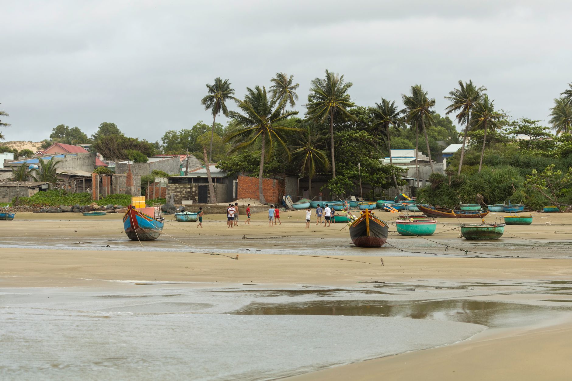
Image by CEphoto, Uwe Aranas via Wikimedia Commons (CC BY-SA)
Getting Here and Using the City
Ha Giang City is the provincial capital and the obvious base for Loop preparation. It has motorbike rental shops, small hotels, and restaurants. Spend a night or two here stocking up on supplies, renting a bike, and getting local advice on current road conditions.
The city itself is not a destination. It's a launching pad. But that's its strength — you're not fighting urban traffic or crowds before you head into the mountains.
From Hanoi: The most common route is the sleeper bus from My Dinh bus station in Hanoi, departing around 8-9 PM and arriving around 4-5 AM. Tickets run 250,000-350,000 VND depending on the operator. Hang Bac, Hai Van, and Cau Me are reliable companies on this route. Day buses run too but eat an entire travel day. There is no train to Ha Giang, and the nearest airport is Noi Bai in Hanoi. Some travelers ride their own motorbike from Hanoi — the 300 km ride takes a full day with stops, passing through Ha Giang's southern foothills via QL2.
In the city: Most hostels and "nha nghi" (guesthouses) cluster along Nguyen Trai Street and the blocks around the central market. Budget rooms start at 100,000-200,000 VND per night; mid-range hotels with hot water and decent Wi-Fi run 300,000-500,000 VND. The city market ("cho Ha Giang") is worth a morning visit — not for souvenirs, but to grab supplies: sunscreen, snacks, a cheap poncho, or phone charging cables you forgot to pack.
Motorbike rental shops line the main road near the hostels. Expect to pay 150,000-250,000 VND per day for a Honda Win or Wave; semi-automatic bikes are cheaper, manual bikes slightly more. A deposit of your passport or a cash deposit (usually 3,000,000-5,000,000 VND) is standard. Check brakes, tires, and lights before you ride out — there are no Honda dealerships on the passes.
Eating in Ha Giang City
Don't expect the food scene of Hanoi or Saigon, but Ha Giang City eats well for a small provincial capital. The food here leans northern — think "pho" for breakfast, "bun" soups for lunch, grilled meats and rice for dinner.
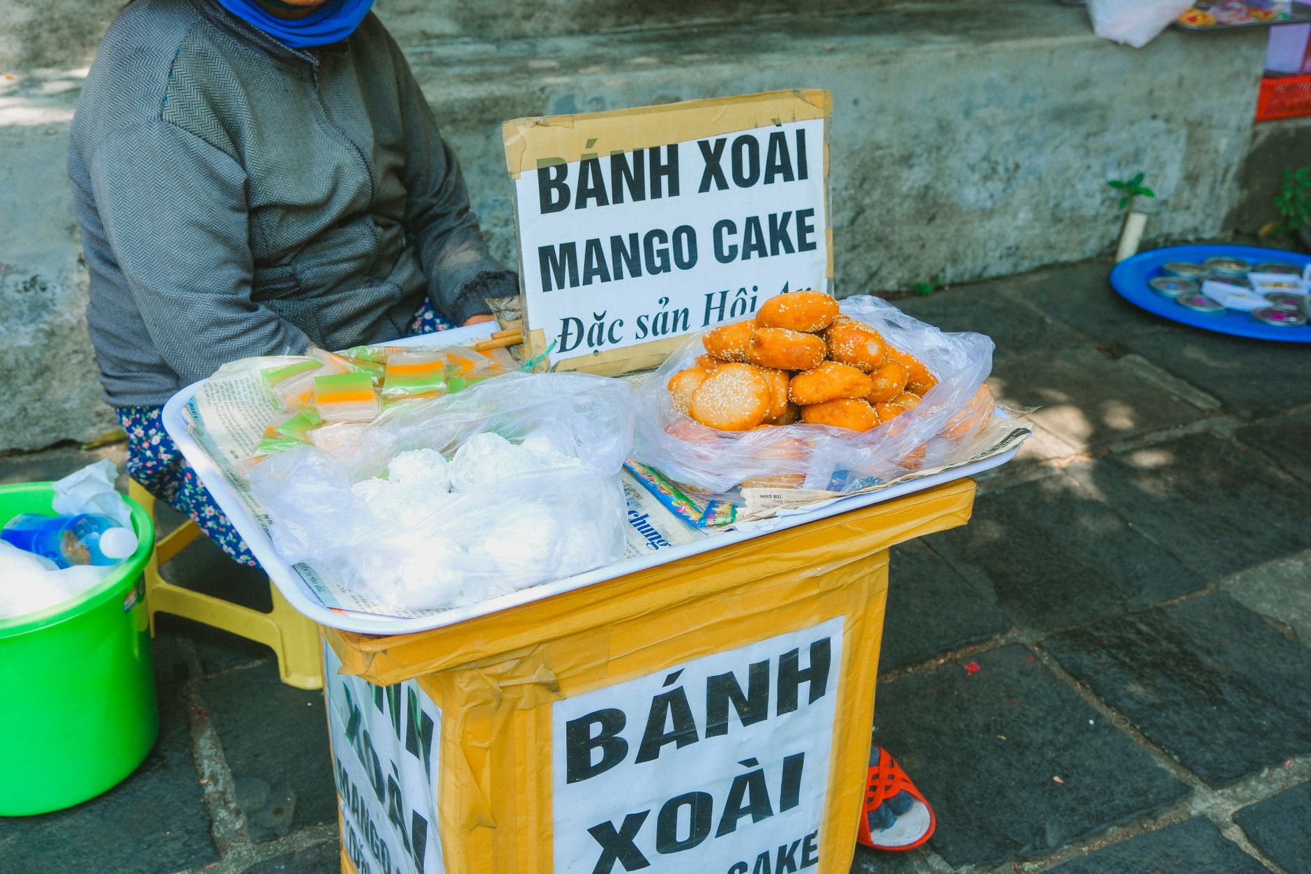
Breakfast is simple: "pho" or "bun rieu" (crab-tomato noodle soup) at one of the street-front shops near the market, 30,000-40,000 VND a bowl. "Banh cuon" (steamed rice rolls) is another morning staple — look for the shops where women spread batter over fabric-covered steamers. A plate with dipping sauce and fried shallots costs about 25,000 VND.
For something specific to the region, try "chao au tau" — a rice porridge with au tau root that Hmong communities prepare during cold months. It has a mildly numbing, warming effect. Several restaurants in the city serve it during winter, typically 30,000-50,000 VND. Also keep an eye out for "men men," a crumbly steamed corn dish that's a Hmong staple — you're more likely to find this at homestays on the loop than in the city, but some local restaurants serve it.
"Ca phe" (coffee) in Ha Giang is straightforward. A "ca phe sua da" (iced milk coffee) at any streetside shop runs 15,000-25,000 VND. Don't expect the egg coffee scene of Hanoi here — this is a town where people drink coffee to wake up, not to photograph it.
On the loop itself, Dong Van and Meo Vac have a growing number of restaurants catering to travelers. Prices are slightly higher than in the city — a rice plate with grilled pork might be 50,000-60,000 VND instead of 35,000-40,000 VND. Carry snacks, crackers) for the stretches between towns where food options disappear.
Common Mistakes and What Surprises Foreigners
Underestimating the roads. The Ha Giang Loop is not a casual ride. Sections of QL4C are narrow, steep, and shared with trucks, water buffalo, and children walking to school. If you've never ridden a motorbike before, this is not the place to learn. Consider hiring an "easy rider" — a local driver who takes you on the back of their bike — for 600,000-900,000 VND per day including the bike and fuel.
Assuming you need a permit. Ha Giang used to require a special travel permit for foreigners heading north of the city. As of recent years, this is no longer enforced for the standard loop route, but rules can shift. Check with your hostel the night before you ride out.
Packing too heavy. You're on a motorbike. One backpack is enough. Leave your rolling suitcase in storage at your Ha Giang City hostel (most offer this free or for 20,000 VND/day).
Skipping fuel stops. Gas stations are spaced far apart on the northern sections of the loop. Fill up whenever you see a pump. Between Dong Van and Meo Vac, there's essentially one reliable station. Locals also sell petrol from roadside bottles (usually 15,000-20,000 VND per liter, slightly marked up), but quality varies.
Expecting phone signal everywhere. Viettel has the best coverage in the mountains, but you'll still hit dead zones on the passes between Dong Van and Meo Vac. Download offline maps (Maps.me or Google Maps offline) before leaving the city.
Comparing it to Sapa. Travelers who've done Sapa sometimes arrive expecting a similar setup — cable cars, organized trekking tours, polished homestays. Ha Giang is rougher, less developed, and more spread out. That's the point. If you want infrastructure, Sapa delivers. If you want roads that feel genuinely remote, this is where you go.
Quick Reference: Ha Giang City at a Glance
- Location: 300 km north of Hanoi, northeastern Vietnam, on the Lo River
- Elevation: ~100 m in the city; passes on the loop exceed 1,500 m
- Population: ~55,500 (city), ~900,000 (province)
- Best months: October-April (dry season); November for buckwheat flowers
- Getting there: Sleeper bus from Hanoi My Dinh station, 6-7 hours, 250,000-350,000 VND
- Budget rooms: 100,000-200,000 VND/night
- Motorbike rental: 150,000-250,000 VND/day
- Loop duration: 3-4 days (standard), 5-6 days (extended)
- Currency: VND only — no ATMs once you leave the city until Dong Van (and that one isn't always working). Withdraw enough cash before you ride out. Cards are not accepted outside the city.
- Language: Vietnamese. Very little English spoken outside hostels. Useful phrases: "Xin chao" (hello), "Bao nhieu?" (how much?), "Do xang o dau?" (where's the petrol station?)
- SIM card: Viettel recommended for mountain coverage. Buy in Hanoi or at shops on Nguyen Trai Street in Ha Giang City for about 100,000 VND with data.
Administrative Layout
The city is divided into five wards (Tran Phu, Minh Khai, Nguyen Trai, Quang Trung, Ngoc Ha) and three communes (Phuong Thien, Phuong Do, Ngoc Duong). This matters mostly for navigation — wards are more developed and closer to the city center; communes are more rural. Most services for travelers cluster near Tran Phu Ward, the oldest and most commercial district.
Frequently Asked Questions
How long does the bus ride from Hanoi to Ha Giang City take?
The bus from Hanoi to Ha Giang City covers roughly 300 km and takes 6-7 hours. The distance sounds manageable, but once you pass Tuyen Quang province the road winds through foothills, slowing progress significantly. Most traveler services in Ha Giang City are on the western bank of the Lo River, so confirm your drop-off point when booking.
What is the typical route and duration for the Ha Giang Loop?
Most riders complete the loop in 3-4 days. A standard itinerary runs: Ha Giang City to Yen Minh (100 km, 3-4 hours), Yen Minh to Dong Van (45 km), Dong Van to Meo Vac (22 km via Ma Pi Leng Pass), then Meo Vac back to Ha Giang City (around 150 km). The route passes through Lung Cu, Dong Van, Sa Phin, and crosses the Dong Van Karst Plateau Geopark, designated in 2010.
When should you arrive at Dong Van or Meo Vac Sunday markets?
Arrive before 8 AM to catch the livestock trading area, where water buffalo and pigs change hands. By midday the crowds thin considerably. Both Dong Van and Meo Vac hold Sunday markets drawing Hmong, Lo Lo, Pu Peo, and Tay traders from surrounding villages. While there, look for thang co, a Hmong sour organ-meat soup, which costs around 20,000 VND a bowl.
Final Note
Ha Giang City is honest about what it is: a small, functional town that exists at the edge of something extraordinary. You won't spend much time here, and that's fine. Get your bike, fill your tank, eat a bowl of pho, and head north. The province will do the rest. Just make sure you've pulled enough cash from the ATM before you leave — the mountains don't take cards.
Last updated · May 29, 2026 · independently researched, never sponsored.