Phu Yen Province: Central Coast Beaches and Lagoons
Phu Yen sits on Vietnam's South Central Coast between mountain passes and a fertile plain. Visit for lagoons, fishing villages, and quiet beaches far from the Hanoi-Ho Chi Minh City circuit.

Phu Yen province occupies a narrow strip of Vietnam's South Central Coast, squeezed between the highlands and the sea. The province is less developed and less touristy than neighbors like Nha Trang (냐짱 / 芽庄 / ニャチャン) or Hoi An — which means fewer crowds, lower prices, and a genuine working landscape of rice paddies, shrimp ponds, and fishing boats.
Geography and Natural Attractions
The province is split sharply: 70% hilly and mountainous in the west, 30% coastal plain in the east. Two dramatic mountain passes frame it — Cu Mong Pass to the north and Ca Pass to the south — making overland travel feel like genuine exploration.
The Da Rang River, Vietnam (베트남 / 越南 / ベトナム)'s largest river in Central Vietnam, flows through the heart of Phu Yen and creates a fertile lowland around Tuy Hoa, the capital. The highest peaks reach 1,592 meters on the border with Khanh Hoa province.
Coastal attractions include "O Loan Lagoon," a vast shallow lagoon where fishermen work at dawn; "Xep Beach" and "Long Thuy Beach" — long, quiet stretches of sand with a handful of simple restaurants; Nghinh Phong Tower, a restored colonial-era structure with views; and the coconut groves of Song Cau, a working harbor town where you can eat grilled squid feet-wet on the sand.
Inland, Song Hinh Lake in the southwest offers freshwater swimming and a hydropower dam visible from several viewpoints. The lake is artificial but scenic, ringed by hills.
Towns and Getting Around
Tuy Hoa (pronounced "twee wah") is the capital and largest city — about 80,000 people. It sits on National Route 1 and the North-South Railway, so it's easy to reach by bus or train from Nha Trang (3 hours south) or Quy Nhon (2 hours north). The city itself is functional rather than charming: a grid of markets, motorbike repair shops, and basic pho stalls. Stay for a meal and a look at the riverside, not a week.
Song Cau (pronounced "song kow"), in the north, is a genuine fishing port. Arrive early morning to see the boats unload. The waterfront has a few simple seafood restaurants and a growing number of guesthouses catering to backpackers discovering the coast. It's a half-hour from Tuy Hoa by motorbike.
Dong Hoa, in the south, is smaller and less touristy. It sits near Vung Ro Port, a deep-water harbor 28 kilometers south of Tuy Hoa, notable mainly for logistics and industrial activity rather than visitor experience.
Dong Tac Airport, 10 kilometers south of Tuy Hoa, serves domestic flights to Hanoi, Ho Chi Minh City, and Da Nang. Connections are less frequent than from major hubs.

Photo by Quang Nguyen Vinh on Pexels
Climate and When to Go
Phu Yen has a tropical monsoon climate. The dry season (January–August) is the best time: sunny, warm, and calm seas ideal for beach days and lagoon visits. Average temperature holds steady around 26.5°C year-round.
The rainy season (September–December) brings typhoons and rough seas. Annual rainfall averages 1,600–1,700 mm, concentrated in these months. If you go in shoulder months (April–May or late August), expect occasional afternoon showers but manageable conditions.
What to Eat
Phu Yen's food is tied to the sea and the rice plain. Expect fresh grilled squid, grouper, and shrimp at waterfront stands. "[Com tam](/posts/com-tam-saigon (사이공 / 西贡 / サイゴン)-broken-rice)" (broken-rice bowls with grilled pork or fish) are a staple and excellent value — 25,000–40,000 VND. Fish sauce is made locally and pungent. Rice wine from the region appears in small ceramic cups at family meals.
Tuy Hoa's wet market (near the river) opens at dawn and closes by 10 a.m. Vendors sell live crab, fresh herbs, and produce at local prices. Street food appears after 5 p.m. in the central market area.
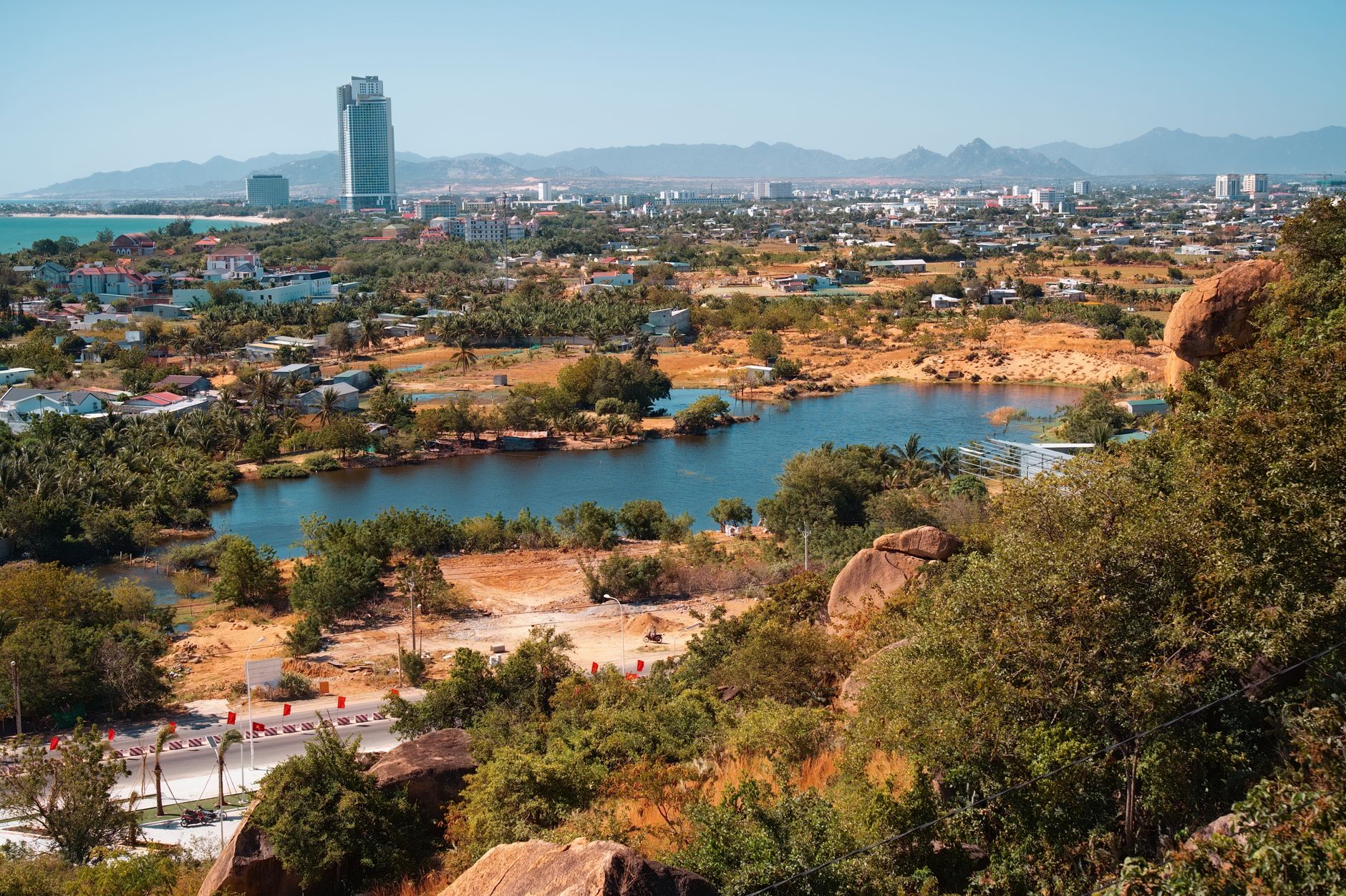
Photo by ㅤ quang vinh ㅤ on Pexels
Practical Notes
Phu Yen is less developed than Khanh Hoa or Quang Nam, so expect fewer English speakers outside Tuy Hoa city and Song Cau's backpacker scene. ATMs and pharmacies exist in Tuy Hoa; bring cash if you venture inland. Mobile coverage (Viettel, Mobifone) is reliable along the coast and main towns.
Administrative divisions include six rural districts, two district-level towns (Dong Hoa and Song Cau), and Tuy Hoa city. Rural areas like Phu Hoa and Son Hoa districts offer motorbike exploration: limestone hills, minority communities (Cham, E De, Ba Na peoples live in pockets), and minimal tourist infrastructure — which appeals to travelers seeking authentic landscape over packaged experience.
Population is roughly 880,000, mostly ethnic Kinh (Vietnamese majority), with significant Cham Muslim communities around Dong Xuan and Son Hoa districts. Cham villages maintain their own mosques and cuisine.
Economy
Phu Yen ranks among the less developed provinces in the South Central Coast. The economy rests on agriculture (rice, sugarcane — it's Vietnam's largest sugarcane producer — cotton, tobacco, pepper, coffee), fishing (aquaculture and ocean fishing combined), and light industry (fish processing, mineral water, beer, cement). Industrial parks near Tuy Hoa and Song Cau are expanding, with a large economic zone developing in southern Dong Hoa aimed at oil refining.
This economic profile means you'll see working agricultural and industrial landscapes, not theme-park development. Roads, ports, and infrastructure are functional but unpolished.
Going to Vietnam? Eat and travel smarter.
Monthly: new dishes, off-the-beaten-path destinations, and itineraries — straight to your inbox. No spam. Unsubscribe anytime.
Join 0 expats. (We just launched.)
More from Central Vietnam
Other articles covering the same region.

Son Doong Cave: Inside the $3,000 Oxalis Expedition
Son Doong is the world's largest cave by volume—and the only way in is a 4-day permit-exclusive tour with Oxalis. Here's what you actually get, who should go, and what cheaper caves offer instead.

Phong Nha Cave: Boat Tours, Dry Caves, and How to Choose
Phong Nha-Ke Bang has two main cave experiences: the iconic river boat through Phong Nha Cave itself, and the dry trek into Tien Son. Here's how to pick, what to expect, and when to go.

Hoi An Lantern Festival: Full Moon Nights and How to Plan Around Them
The Hoi An Lantern Festival happens on the 14th lunar day each month. Electricity shuts off, lanterns float on the Thu Bon River, and crowds triple. Here's how to time your visit and actually enjoy it.
More in Destinations
More articles from the same category.

Japanese Bridge in Hoi An: What to Know Before You Visit
The 400-year-old Japanese Bridge is Hoi An's most iconic landmark. Here's how to see it properly—and avoid the crowds.

Thien Mu Pagoda in Hue: Seven Stories Above the Perfume River
Hue's most recognizable landmark rises 21 metres above the Perfume River. This is the story behind the tower, how to get there, and when to visit without the tour groups.

Lung Cu Flag Tower: Vietnam's Northernmost Point
The drive to Lung Cu Flag Tower takes you to Vietnam's northernmost point at 1,500 metres. It's a half-day trip from Dong Van with a steep climb, mountain views, and nearby Hmong villages.

Hoa Lu Ancient Capital: Vietnam's First Kingdom and How to Visit from Ninh Binh
Hoa Lu was the seat of Vietnam's first independent dynasties in the 10th century. Two surviving temples anchor a quiet bike ride through rice fields just outside Ninh Binh.

Perfume Pagoda Day Trip from Hanoi: Boat, Hike, and Festival Season
A half or full-day pilgrimage from Hanoi to the Perfume Pagoda involves a scenic boat ride through limestone karst, a trek or cable car ascent, and crowds during Tet season. Here's what to expect and how to plan.

Hanoi Old Quarter Walking Guide: 36 Streets, Street Food & Craft Alleys
The 36 streets of Hanoi's Old Quarter were named after the guilds that dominated them—silk, silver, tin, paper. Here's how to walk them, eat on them, and see which craft trades still survive.
Comments
Loading…